EVERY SURVEY BUILT FOR
LEGAL DEFENSIBILITY
EVIDENCE, LAW & REASONING
FULLY DOCUMENTED
HIGHLAND
LICENSED PLS, PE, UTAH
START WITH
A CONSULTATION
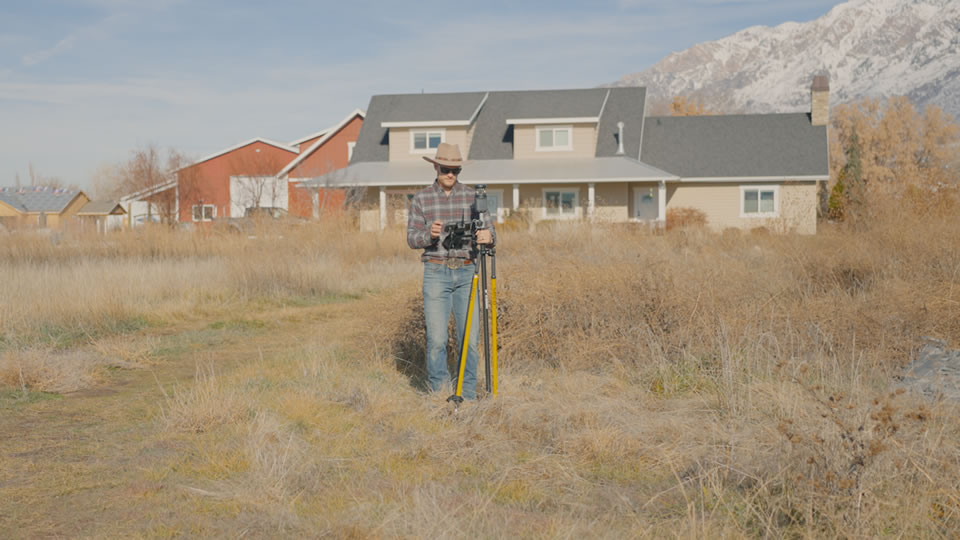
Harnessing Geographic Information Systems (GIS) for Informed Decision-Making
Welcome to our GIS Mapping services, where the power of geographic data and technology converge. At Highland Surveying, we utilize cutting-edge GIS technology to provide you with powerful insights and data-driven solutions for your projects. Discover how our GIS Mapping services can help you make informed decisions and gain a competitive edge.
Data Visualization: Our GIS Mapping services enable you to visualize complex geographic data, making it easier to interpret and analyze.
Trend Analysis: Gain valuable insights into geographic trends and patterns that can inform strategic decisions.
Data Integration: We integrate various data sources, from satellite imagery to survey data, to provide a comprehensive view.
Custom Mapping Solutions: Tailored GIS mapping solutions to meet your specific project needs.
Environmental Analysis: Assess environmental factors and potential impacts on your project.
Tailored GIS Solutions for Your Needs
Our GIS Mapping services are tailored to meet the unique needs of your project. Whether you're in urban planning, environmental analysis, or any field that requires geographic data, we have the expertise and technology to assist you. Let us know your requirements, and we'll create a customized GIS solution that aligns with your goals.
Unlock the Power of Geographic Data
Geographic data is a valuable resource for businesses and organizations across various sectors. With our GIS Mapping services, you can unlock the power of this data, gaining a competitive edge and making data-informed decisions. Whether you need spatial analysis, mapping, or data visualization, we've got you covered.
Experienced GIS Professionals
Our team consists of experienced GIS professionals who are well-versed in the latest technology and methodologies. We bring a wealth of knowledge to every project, ensuring that you receive accurate, reliable, and actionable geographic insights.
Data-Driven Decision-Making
Our GIS Mapping services empower you with the geographic data and tools needed to make strategic choices. Whether it's site selection, resource allocation, or risk assessment, our GIS solutions provide the information you need to succeed.
Start Leveraging GIS Today
Ready to harness the power of GIS Mapping for your projects? Contact us today to discuss your specific needs and explore how our GIS services can provide you with valuable geographic insights. Gain a competitive advantage and make data-driven decisions with Highland Surveying.
Contact Us
For more information, please contact us with any questions.
Real Clients. Real Results.
What Property Owners Say About Highland.
Homeowners, developers, and landowners across Utah trust Highland for accurate, defensible surveying.
Tyler knew exactly what I needed to start my process with a city council. He drew up 3 options I could use without getting expensive survey or engineering work done. He nailed it for what I needed and I will 100% use him for everything when the project moves forward.
Larry P.
Tyler completed our survey for a development project in Harrisville and did a fantastic job, exactly what we needed with great detail. The quality of their work was outstanding, and they maintained clear and consistent communication throughout the entire process.
Jim B.
Fees were reasonable and the end result was better than any company I have worked with in the Utah region. They were able to meet all of our specified criteria for airport work — incredibly precise survey was required and completed perfectly.
Connor B.
We are building a shop and needed a survey to present to planning and zoning. Highland sent me a layout map within a very short time. They were understanding of our limited knowledge and very responsive. We would gladly utilize their skills in the future.
Matt W.
Explore More
Related Services
Geomatics Engineering
Engineering-grade spatial solutions for infrastructure and land projects.
Learn More →Topographic Services
Detailed elevation and terrain mapping for site planning and development.
Learn More →Boundary Survey
Establish exact property lines with court-defensible accuracy.
Learn More →Further Reading
From Our Blog
Stop Guessing.
Establish Certainty.
Get a licensed land surveyor who delivers accurate, defensible results — documented for the public record.
Request a Consultation · Licensed PLS · Court-Defensible Documentation · Wasatch Front & Rural Utah