EVERY SURVEY BUILT FOR
LEGAL DEFENSIBILITY
EVIDENCE, LAW & REASONING
FULLY DOCUMENTED
HIGHLAND
LICENSED PLS, PE, UTAH
START WITH
A CONSULTATION
Detailed Land Mapping for Informed Decision-Making
At Highland Surveying, we understand that comprehensive topographic surveys are essential for successful land development projects. Our Topographic Surveys provide you with in-depth insights into your land's features and contours, enabling you to make informed decisions and plan your project with precision.
Unveiling the Land's Features
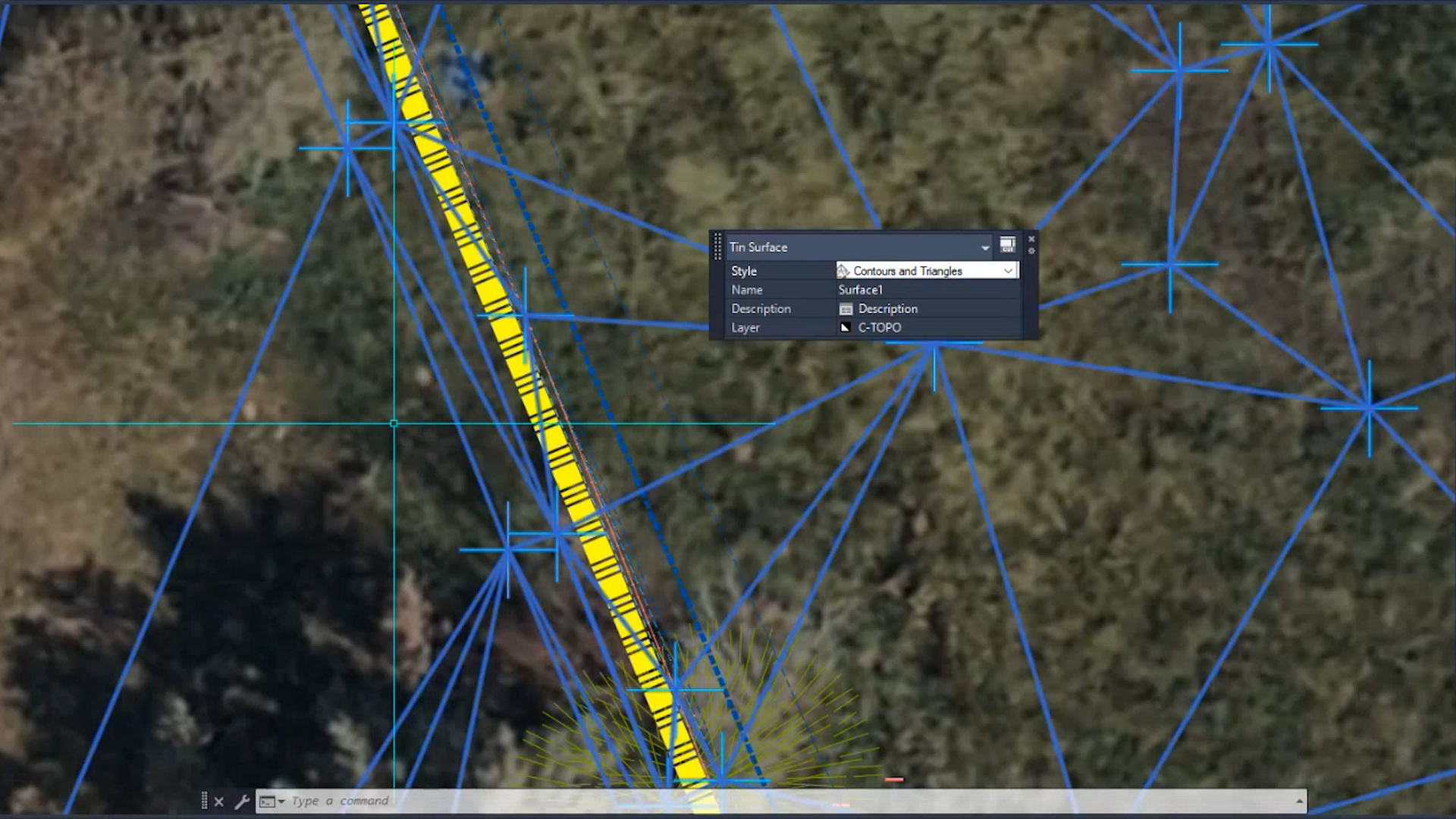
Topographic Surveys go beyond basic property boundaries. They delve deep into your land, capturing essential details such as elevations, natural features, man-made structures, and contours. This comprehensive understanding of your land's features is vital for informed decision-making during the development and planning phases.
Accurate elevation data helps you understand the terrain, while the identification of trees, water bodies, and other natural elements ensures that you have a complete picture of the land's characteristics. Our surveys also include mapping of buildings, roads, and other structures on the land, providing valuable insights into the existing infrastructure. Detailed contour lines allow you to visualize land slopes and gradients, aiding in the design and execution of your project.
Elevations: Accurate elevation data to understand the terrain.
Natural Features: Identification of trees, water bodies, and other natural elements.
Man-Made Structures: Mapping of buildings, roads, and other structures on the land.
Contours: Detailed contour lines to visualize land slopes and gradients.
The Value of Topographic Surveys
Topographic Surveys offer invaluable benefits for your project:
Engineering Design: Precise topographic data aids in the design and planning of engineering projects.
Environmental Assessment: Understanding the land's features is crucial for environmental impact assessments.
Site Suitability: Assessing whether the land is suitable for the intended use.
Risk Mitigation: Identifying potential issues and challenges early in the project planning stage.
Our Topographic Survey Process
Our Topographic Survey Process is a well-defined and comprehensive methodology designed to provide you with the most accurate and valuable data for your project. From our field surveys conducted by experienced professionals to the meticulous data processing and mapping, every step is undertaken with precision and attention to detail. Our commitment to analysis ensures that the data we provide isn't just raw information but meaningful insights to support your project's success.
At Highland Surveying, we follow a systematic approach to conducting Topographic Surveys:
Field Survey: Our experienced surveyors visit the site to collect accurate data using advanced equipment.
Data Processing: We process the survey data, ensuring accuracy and completeness.
Mapping: We create detailed topographic maps, highlighting key features and elevations.
Analysis: Our team analyzes the data to provide you with meaningful insights for your project.
Why Choose Highland Surveying for Topographic Surveys?
At Highland Surveying, we take pride in being your trusted partner for topographic surveys. Our commitment to excellence extends to every aspect of our surveying services. We combine precision, efficiency, and compliance to deliver accurate and reliable data that empowers your project. With Highland Surveying, you can rely on a team dedicated to providing you with the insights needed for informed decision-making.
Precision: We prioritize accuracy and precision in our surveys, ensuring the data is reliable for your project.
Efficiency: Our experienced team works efficiently to meet project deadlines.
Compliance: Our Topographic Surveys adhere to all relevant regulations, providing peace of mind.
Data-Driven Decision-Making: We equip you with the data needed to make informed decisions.
Contact Us
For more information, please contact us with any questions.
Real Clients. Real Results.
What Property Owners Say About Highland.
Homeowners, developers, and landowners across Utah trust Highland for accurate, defensible surveying.
Tyler knew exactly what I needed to start my process with a city council. He drew up 3 options I could use without getting expensive survey or engineering work done. He nailed it for what I needed and I will 100% use him for everything when the project moves forward.
Larry P.
Tyler completed our survey for a development project in Harrisville and did a fantastic job, exactly what we needed with great detail. The quality of their work was outstanding, and they maintained clear and consistent communication throughout the entire process.
Jim B.
Fees were reasonable and the end result was better than any company I have worked with in the Utah region. They were able to meet all of our specified criteria for airport work — incredibly precise survey was required and completed perfectly.
Connor B.
We are building a shop and needed a survey to present to planning and zoning. Highland sent me a layout map within a very short time. They were understanding of our limited knowledge and very responsive. We would gladly utilize their skills in the future.
Matt W.
Explore More
Related Services
Boundary Survey
Establish exact property lines with court-defensible accuracy.
Learn More →ALTA/NSPS Surveys
Comprehensive commercial survey standards for lenders, title companies, and major transactions.
Learn More →Civil Engineering
Site design, grading plans, and engineering solutions for Utah development projects.
Learn More →Stop Guessing.
Establish Certainty.
Get a licensed land surveyor who delivers accurate, defensible results — documented for the public record.
Request a Consultation · Licensed PLS · Court-Defensible Documentation · Wasatch Front & Rural Utah